Italy Unification map
The extent of the Kingdom of Italy as at 1861 is indicated on this map together with the outlines of several now defunct, because incorporated, states. The principal territories which were regarded, at this time, by "Italian" feeling as being future subjects for incorporation were Venetia and Rome.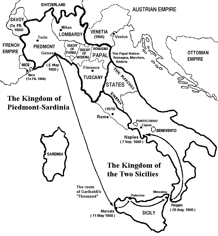 |
Map Source: the map above is based on map 90 titled "The Kingdom of Sardinia" drawn by Berit Lee in Historical Atlas of the World (Edinburgh, 1970; original edition: Oslo, 1962).

|