Space Archaeology
Satellite infra-red imaging
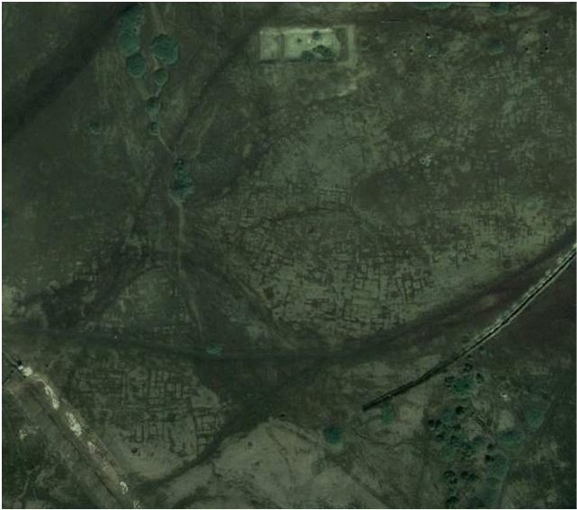
Street plan of Tanis
Archaeologist Sarah Parcak says she has discovered thousands of ancient sites in Egypt, from pyramids to a detailed street plan of the city of Tanis,
an A-to-Z of the region's northern capital - all thanks to images from space satellites orbiting 700 kilometers, (or 435 miles), above the Earth.
The infrared pictures are capable of tracing structures buried deep in the sand. "It just shows us," she adds, "how easy it is to underestimate both
the size and scale of past human settlements."
More than 1,000 tombs and 3,000 ancient settlements were also revealed by looking at infrared images which show up underground buildings
due to the differing densities between the rather dense mud-bricks used in Ancient Egypt in building construction and the typically less dense
surrounding sands or soils under which mud brick building foundations may often now lay buried. The cameras on the satellites are so powerful they can spot objects of less than a metre in diameter.
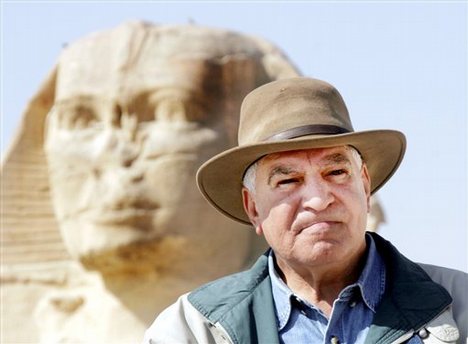
The work has been pioneered at the University of Alabama at Birmingham by US Egyptologist Dr Sarah Parcak.
She says she was amazed at how much she and her team has found.
The full extent of the street plan of Tanis, once the capital of ancient Egypt, and a site made famous by the Indiana Jones film Raiders
of the Lost Ark, has also been revealed ~ and appears to suggest a scale some four times greater than had previously been imagined.
Thanks to satellite facilitated infrared imaging techniques Parcak discovered an ancient network of streets and houses at Tanis, which are completely invisible from the ground.
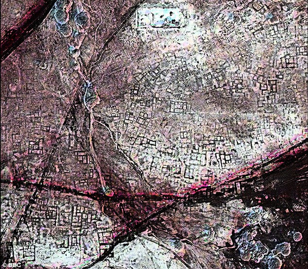
An ancient streetmap: A satellite image shows a once densely occupied city of Tanis to be littered with underground tombs. Buildings in ancient
Egypt were constructed out of mud brick
- the material is dense, allowing satellites orbiting above Earth to photograph the outlines of structures completely invisible to the human eyes
of even trained archaeologists in ground surveys.
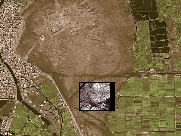
Modern city San El Hagar on the left, with the inset showing the location of ancient Tanis.
Whilst researching this page we came across a Google Earth image of the same area. This image might be held to give some hint of what was there,
in the way of an underlying Tanis street map, to be more fully dicovered by space satellite archaeology.
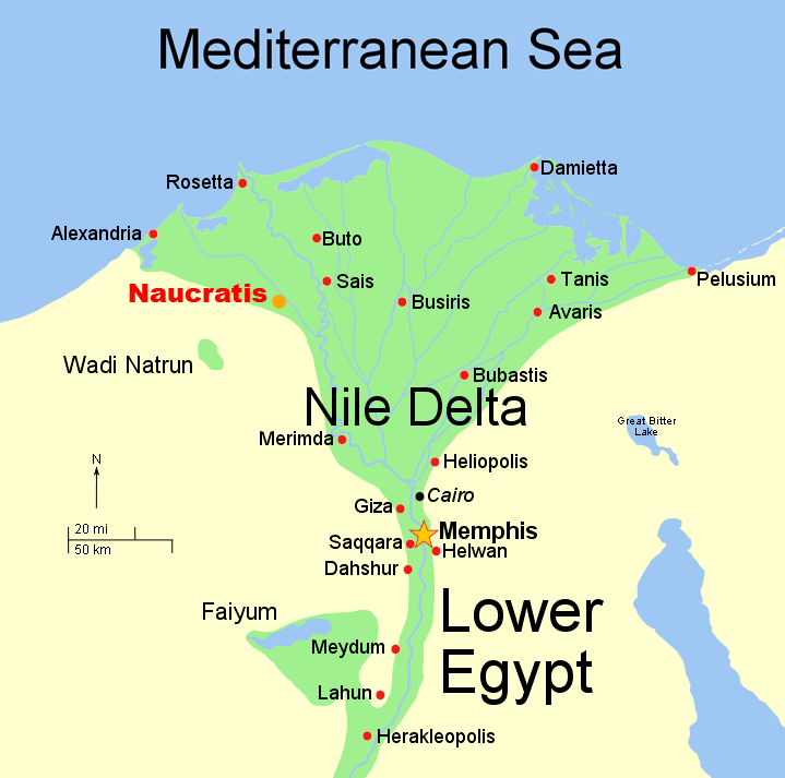
On a larger scale map Tanis appears north-east of Cairo, and in the Nile Delta.
To further test some of the most recent satellite finds, Parcak enlisted the help of a French archaeological team which already had a
long history of digging at
the 3000-year-old Tanis site. The satellite data
revealed a warren of mud-brick walls, a maze-like street plan, and large residences that may have housed the wealthy. So the French team chose
a structure from the images and
excavated there. Beneath about 30 centimeters of sediments, they discovered mud brick walls. "They found an almost 100% correlation between
what we see on the imagery and
what we see on the ground," Parcak says. "They'd excavated a 3,000-year-old house that the satellite imagery had shown and the outline of the structure
matched the satellite imagery almost perfectly. That was real validation of the technology."
Dr Sarak Parcak is considerably enthuisiastic about implications of the satellite facilitated discernment of the street map of ancient Tanis.
"This hints at the possibilities of discoveries to come," she said. "I am excited for my generation and the generations to come. There is enough to be excavated for 50 generations to come."
Parcak's research was funded by a grant from the BBC in hopes of exploring how satellite imagery can be used in conjunction with archaeology.
 Parcak worked with Zari Hawass, Ph.D., Egypt's Minister of State for Antiquities, who was instrumental in her being allowed access to the excavation sites. Parcak worked with Zari Hawass, Ph.D., Egypt's Minister of State for Antiquities, who was instrumental in her being allowed access to the excavation sites.
This is the first time Parcak has done a discovery on this a large a scale, she said. She also plans to partner with Hawass for training young
Egyptians to do this work as well.
"It is important that we map out our ancient history before it's gone," she said.
|
|
![[street plan, NASA, satellite imaging, tanis]](archaeologist.gif)